Svelmø
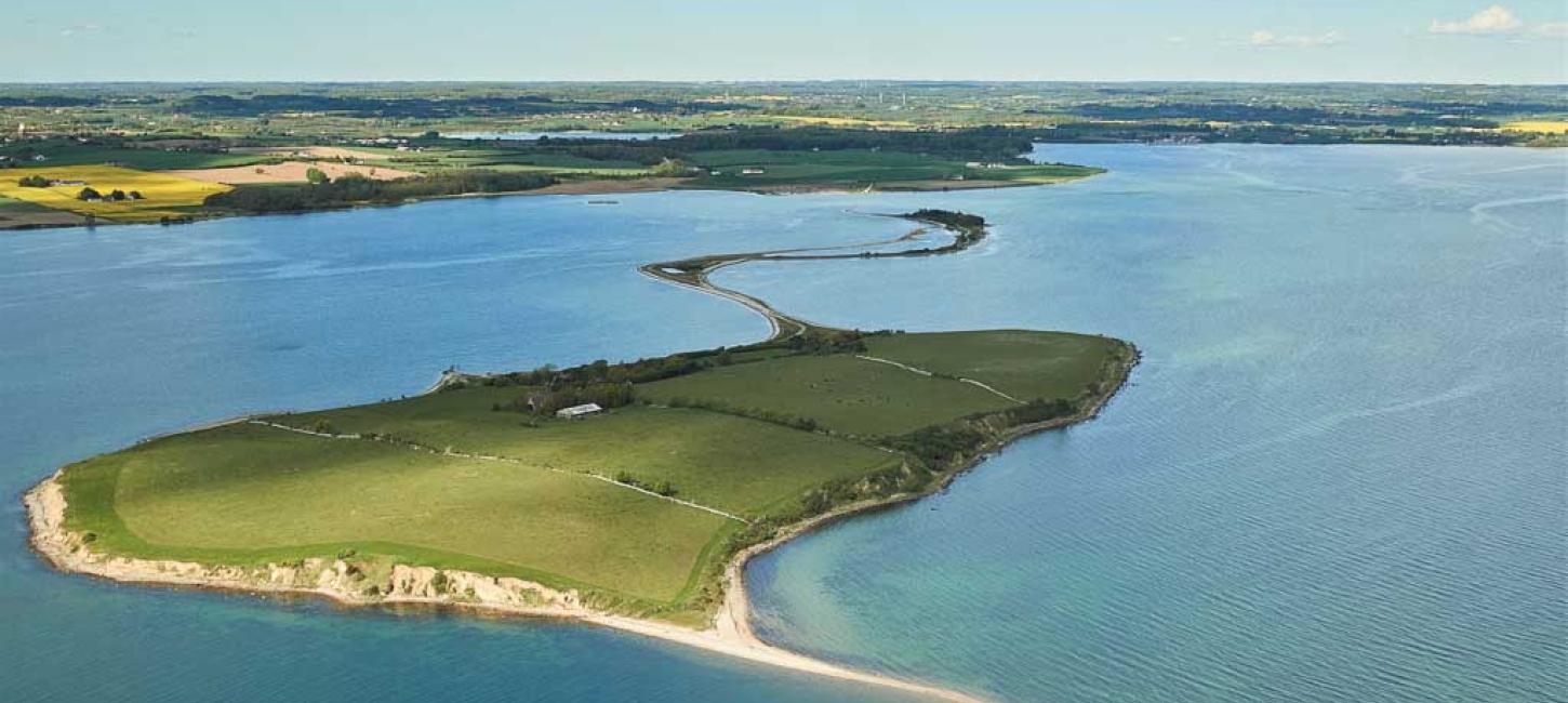
Svelmø is a small island complex off the coast of South Fyn, consisting of Lille Svelmø, Græsholm, and Store Svelmø. The three islands were once separate but are now connected with natural isthmuses.
In order to reach Svelmø, you have to wade about 500 m along the ebb road connecting Fyn with Lille Svelmø. The water may reach your thighs, so the most comfortable time of year to do the trip is late summer. There are parking spots, a public toilet, and info boards where the ebb road starts on Fyn – remember to check the weather and water level forecasts before setting out on the trip.
Svelmø is privately owned, and visitors must follow the rules regarding public access to private areas. The beaches, however, are accessible to everyone, and a walk along the beach of Store Svelmø is a great experience for those wishing to be at one with nature.
One of the South Fyn Archipelago’s largest colonies of arctic terns and common gulls are found on Svelmø. Furthermore, the cliffs of Store Svelmø are home to a large colony of sand martins. Out of consideration for breeding birds, visitors are encouraged to stay on the gravel road while crossing Lille Svelmø and Græsholm during the period 1 April to 15 July.
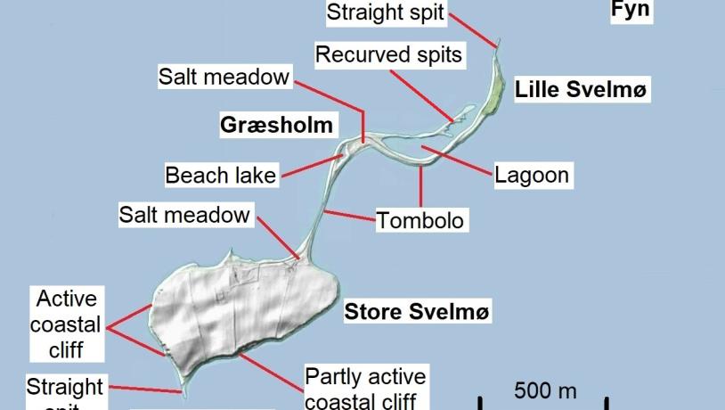
Photo:Hill-shade map of Svelmø. Map: GeoFyn. Illustrated: Søren Skibsted
The Glacial Landscape of Svelmø
The hilly terrain of Store Svelmø was formed when stagnant masses of dead-ice melted. The highest parts of the landscape consist of meltwater deposits.
On the east coast of Lille Svelmø and along the west coast of Store Svelmø, the cliffs exhibit the building blocks of the ice-age landscape. On Store Svelmø, you can see meltwater sand and gravel as well as various types of moraine clay and moraine sand, deposited by three separate ice advances during the Weichselian glaciation. Visible in some of the layers are lumps of meltwater sand, which, in frozen condition, were detached from the substrate as the ice moved across it. Also visible in the cliffs are Weichselian meltwater clay, as well as layers of ‘sticky’ clay and alternating layers of clay and sand, which might date from the last interglacial period, the Eemian (130-115,000 years ago).
In the cliffs, a freshwater deposit has been found, consisting of so-called diatomite or kieselguhr. The deposit has a characteristic content of larch pollen, which could indicate the presence of an interglacial period previously unrecorded in the South Fyn Archipelago.
On both Lille Svelmø and Store Svelmø, the topmost soil layers consist primarily of fertile moraine clay, perfect for farming on the islands.
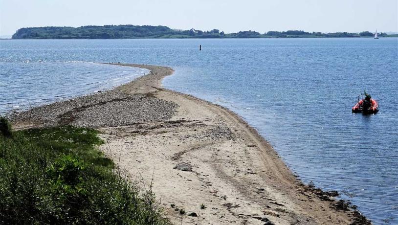
Photo:Søren Skibsted
The Dynamic Coastal Landscape
After the last glacial period, the sea inundated the area south of Fyn, thus creating the South Fyn Archipelago. At this point in time, Lille Svelmø, Græsholm, and Store Svelmø – as well as a small moraine mound between Lille Svelmø and Græsholm – were separate islands off the coast of South Fyn.
The sea eroded the southern and western coasts of Store Svelmø, resulting in prominent coastal cliffs. Long-shore currents transported loose clay, sand, and gravel to the shallow waters north of the island. Here, the materials were deposited as marine forelands, slowly connecting the four islands. Such natural connections between land masses are called tombolos.
As Lille Svelmø’s and Græsholm’s new landscapes stabilized, vegetation settled in. Today, most of these islands are covered by salt meadows and grasslands with a rich plant life. During storms and extremely high tides, the lowest parts may become flooded, especially the tombolo between Store Svelmø and Græsholm.
Since the 1950’s, the continued growth of a number of small, recurved spits has formed a narrow, 450 m long sandy barrier west of the tombolo connecting Græsholm and Lille Svelmø. The spits have nearly tied off the shallow lagoon from the sea, and the area has become an important breeding site for birds.
To the south, Store Svelmø ends in a 250 m long straight spit called Svelmø Trille, which continues toward the southeast as a shallow submarine reef before the seabed slopes downward to a depth of 18 m in what is known as the Ringsgård Basin.
Longitude: 10.330238
Latitude: 55.040418