Lindelse Nor & Henninge Nor
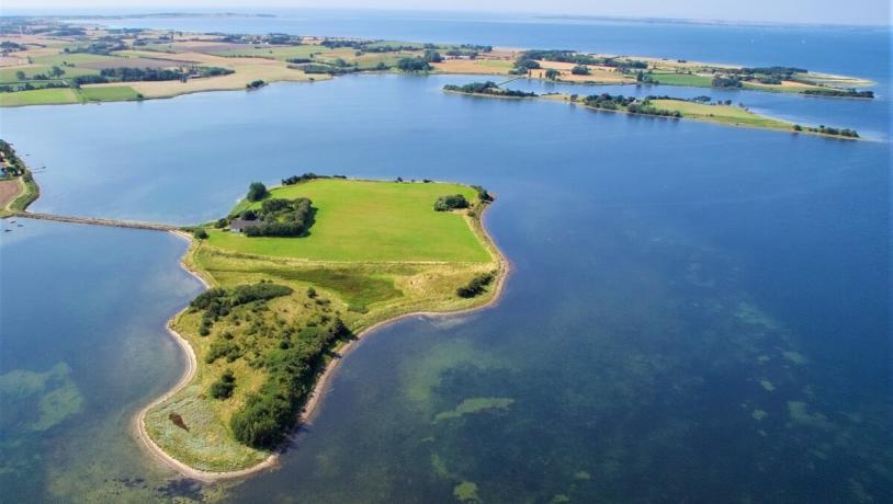
Lindelse Nor, located five kilometers from Rudkøbing, is a 10 square kilometer shallow bay with seven islets and islands. Two of them are inhabited.
Lindelse Nor is one of the geopark's finest examples of a drowned Ice Age landscape. On the seabed are tree trunks and stumps from Stone Age forests, as well as flooded settlements with countless cultural traces of hunter-gatherer societies that had to leave their habitats and move further up the terrain as the sea rose.
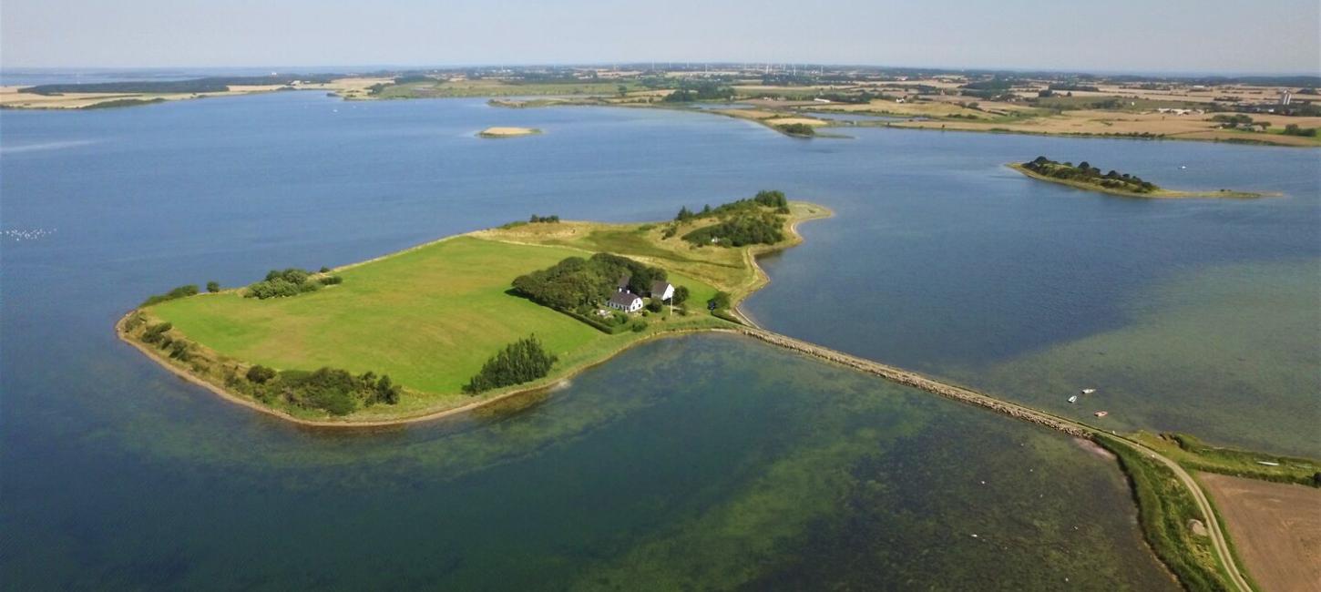
Lindelse Nor med Lindø i forgrunden og Langø i baggrunden til højre. Foto: DroneFyn.dk. Geopark Det Sydfynske ØhavPhoto:DroneFyn.dk
Lindø is home to a large Stone Age settlement, and around the landscape you'll find dolmens, stone pillars and burial mounds from the Stone, Bronze and Iron Ages. In Henninge Nor, piles from the Iron Age, Viking Age and early Middle Ages have been found, indicating a former centre of power and trade. At Købeshoved, there was a trading centre that may have been the precursor to Rudkøbing. And a rampart forms the northern part of Kværnen.
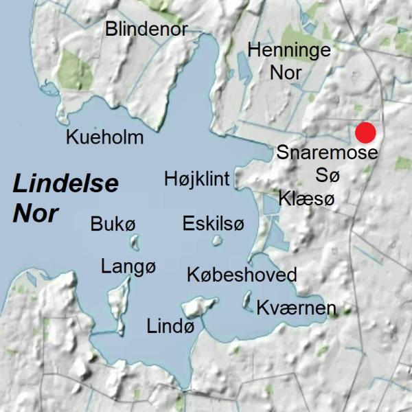
Public access to Lindelse Nor is limited, but the northwestern part can be reached via a branch of the Archipelago Trail along the west side of Henninge Nor. Another option is to take a path from the parking lot at Klæsø to the north. Following this path will take you to Langeland's largest stone, the Søstenen - a 2.2 meter high and approximately 50 tons heavy boulder of coarse-grained, so-called porphyritic granite of roughly the same type that occurs in the bedrock around Karlshamn in southern Sweden. The giant rock melted free of the ice around 16,500 years ago. It is marked with a red dot on the map below.
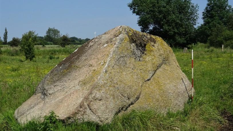
Søstenen, Langelands største kendte vandreblok. Målestokken er 120 cm høj. Geopark Det Sydfynske Øhav.Photo:Søren Skibsted
The ice age landscape at Lindelse and Henninge Nor
Much of the landscape around Lindelse Nor consists of moraine surfaces from the late part of the last ice age, Weichsel. There are also dead-ice landscapes, wash basins, meltwater plains and hat hills up to 26 metres high, which are either scattered or in short rows in the terrain. Towards the end of the Ice Age, low-lying parts of Lindelse Nor may have served as drainage areas for the water from melting dead ice left behind by the 'Great Belt Glacier', which covered Langeland and the Great Belt region 18-17,000 years ago. Deposits from this ice stream are visible in the low cliffs. A few thousand years after the end of the ice age, the area was flooded by the sea and Lindelse Nor was transformed into a small independent archipelago with a strongly lobed coastline and numerous islands
100 years ago, there were 11 islands and islets in the nor. Three of them (Egholm, Kamsø and Næsholm) are today part of the now dammed Henninge Nor, where they can be seen as elevations surrounded by meadows and wetlands. The island of Flintholm used to lie in the centre of Lindelse Nor, but in the 1960s the sea reduced the island to a stone reef. Several of the islands in Lindelse Nor are the tops of hat hills rising out of the sea.
Longitude: 10.704717
Latitude: 54.878994