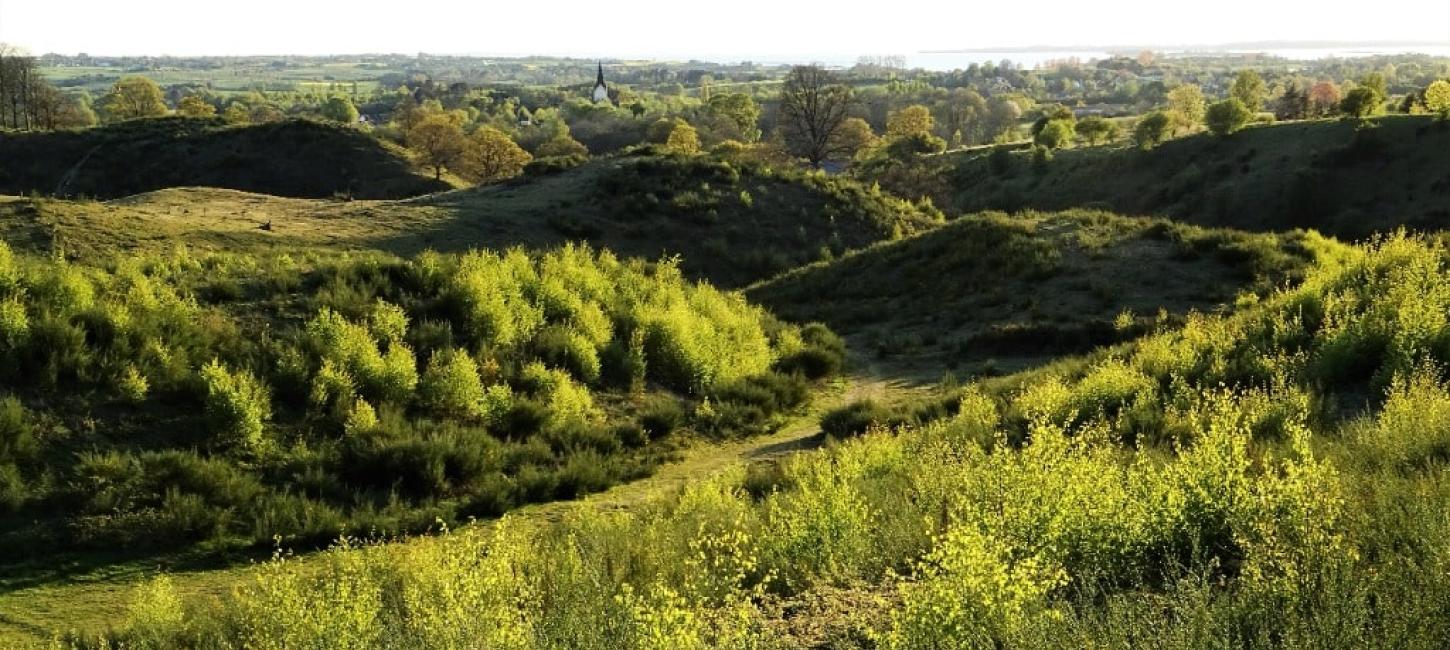
Svanninge Bakker og Bjerge
Svanninge Bakker and Svanninge Bjerge (meaning ‘the hills/mountains of Svanninge’ respectively) are parts of the so-called ‘Alps of Fyn’ - a 16 km long and 6-8 km wide range of hills reaching a height of 128 m.
Getting there is easy by bus or on bike, and if you arrive by car, there are several parking sites with toilets.
The hills are Fyn’s most visited natural area. The Archipelago Trail (for hikers), the horseback riding trail Riderute Sydfyn, as well as several bicycle routes all traverse the area, which is ideal for mountain biking as well. There are several eateries in the area, and one of Denmark’s largest nature playgrounds is located at Gåsebjerg Sand where you can also find a number of mountain biking trails.
Svanninge bakker og bjerge. Geopark Det Sydfynske Øhav. Photo:Mikkel Jézéquel
From the Neolithic onwards, human activity led to massive deforestation in Svanninge Bakker and Bjerge. Until the mid-19th century, the heather-covered Svanninge Bakker were used for grazing and the gullies used for low-yield farming.
However, the area was replanted later in the same century to prevent sand drift and to ensure a steady supply of firewood and timber. After the hurricane in 1999, the former grasslands (commons) in Svanninge Bakker have been partly re-established.
The rich cultural history of the area is still visible: earth walls, stone walls, ridge and furrow fields, sunken roads, remains of houses, old wells, and small overgrown sand and gravel pits as well as the water-filled clay pit, which belonged to the long defunct brickyard Gærup Teglværk.
Svanninge Bakker and Sollerup Skov is owned by the Danish Nature Agency, while Svanninge Bjerge is privately owned by the Bikuben Foundation. Therefore, different rules regulate access to the two parts of the hill country.
The Glacial Landscape in Svanninge Bakker and Bjerge
The hills of Svanninge Bakker and Bjerge are – along with the rest of the ‘Alps of Fyn’ – one of the most striking glacial landscapes on Fyn. ‘The Alps’ are believed to have been formed by three separate ice advances in the last glacial period, the Weichselian, which ended approximately 11,700 years ago.
When the ice sheet reached its maximum extent along the Main Stationary Line 22.000 years ago in central Jylland, it started to melt. During deglaciation, several re-advances occurred where the ice sheet briefly moved forward again. These re-advances left prominent northwest-southeast trending terminal moraines, and it is possible that one of the re-advances formed the initial parts of the ‘Alps of Fyn’.
Today, Fyn’s largest lake, Arreskov Sø, occupies a so-called central depression, from which the glacier picked up a lot of the material, which was pushed together in the terminal moraine. Later, when the ice stream stagnated, the depression was filled with vast dead-ice masses.
While the dead-ice from the Main Weichselian Ice Advance still covered large parts of central Fyn, the East Jylland Ice Advance (19-18,000 years ago) moved across the area from the southeast, crossing the newly formed terminal moraine. When parts of this ice advance then stagnated later on, the ice sheet melted especially fast at its thinnest places: e.g., on top of the terminal moraine. Lake basins and depressions formed on top of the terminal moraine where large amounts of meltwater sand and gravel, and various types of moraine sediments could be deposited. When the ice melted away, the deposits were left as a high-lying undulating terrain characterized by numerous hills, hollows, and highly variable soil conditions. The last ice advance, the Bælthav Ice Stream (18-17,000 years ago), affected only the southernmost parts of the hills.
Lerbjerg (126 m) is the highest point of Svanninge Bjerge. Lerbjerg is a kame hill with layers of clay and sand deposited in what used to be a lake basin surrounded by ice. When the ice melted away, the sediments remained as a free-standing hill. Elsewhere, meltwater clay was deposited in low-lying basins where it became the basis for small local brickworks.
The ridges and gullies in Svanninge Bakker were formed by meltwater erosion at the end of the Weichselian. The parts of the sandy terrain which were not removed by the water, remained as steep ridges. This special landform is termed false hills.
The source of Fyn’s largest stream, Odense Å, is located at Hammerdammen, north of Svanninge Bakker. The stream, which is called Rislebækken at this point, runs through the scenic erosional valley known as Helvedes Hule (‘Hell’s Hollow’), and from there it continues to Arreskov Sø. The deep valley separating Svanninge Bjerge and Sollerup Skov was most likely formed by meltwater from melting dead-ice at the end of the Weichselian. In the westernmost part of Svanninge Bakker, a number of springs trickle out at the foot of the hills.
Østsiden af Lerbjerg, Svanninge Bjerge. Geopark Det Sydfynske ØhavPhoto:Søren Skibsted
Longitude: 10.268609
Latitude: 55.124498