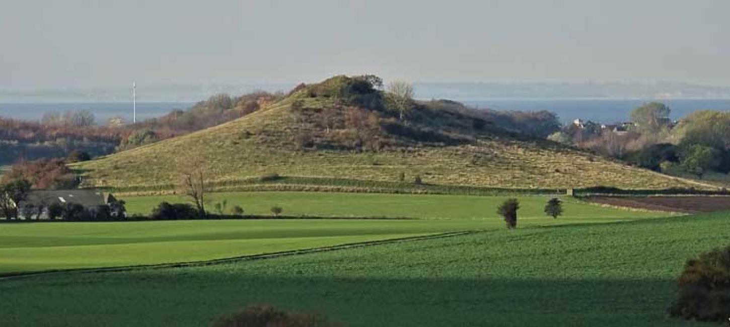
Hatbakken Fakkebjerg (The Hat Hill of Fakkebjerg)
The landscape of Langeland is characterized by over 1200 dome-shaped hills called hat hills.
The name 'hatbakke', meaning 'Hat Hill', originated during an excursion around 100 years ago, when a Danish female geologist wore a so-called bell hat, which was all the rage in the 1920s. In some areas, the hat hills appear in parallel, kilometer-long rows, while in others they are found singly or in irregular patterns. Skovlebjerg (46 meters) north of Tryggelev is Langeland's highest point with its twin peaks. Like most other hat hills it is located on private land with no public access.
However, Fakkebjerg and several of the hat hills between Bagenkop and Dovnsklint are publicly accessible. Fakkebjerg, located two kilometers southeast of Bagenkop, is 37 meters high. From the top you can see all of southern Langeland - and in clear weather also Lolland, Ærø and the north German coast. Fakkebjerg has an oval shape measuring 370 x 200 meters and rises 30 meters above the surrounding terrain. From 1806 to 1905 there was a lighthouse at the top, and after World War 2 and until 1972 there were several different lighthouses. After World War II and until 1972, there were several different radar systems.
500 meters southwest of Fakkebjerg - at the foot of a small hill - is the impressive Hulbjerg Jættestue (Hulbjerg Burial Mound) from the Neolithic Age. Here you can crawl through a long passageway into a stone-built burial chamber where at least 53 people, including 17 children, have been laid to rest. Among other things, the burial chamber contains a skull with the only known example of a dental drill from ancient Denmark - a root canal drilled with a flint drill to drain inflammation from a dental abscess. Tartar in the hole shows that the patient survived the treatment.
Photo:Mikkel Jézéquel
The ice age landscape and the hat hills
Scientists have long debated how the Hat Hills were formed, and now modern research has shed some light on the subject.
Around 17,500 years ago, Langeland and the Great Belt region were covered by a tongue-shaped outlet, the 'Great Belt Glacier', which was part of the Bælthav Ice Stream. When the glacier stopped advancing and the outermost parts of the ice turned into dead ice. Along the edge of the melting ice, large crevasse systems and depressions appeared on the surface of the ice. The cracks and depressions filled with meltwater and ice lakes formed.
Some of the material that melted from the ice was carried with the meltwater into the ice lakes. Here, the materials were sorted by the water and deposited as layers of clay, sand and gravel. Sometimes layers of unsorted moraine clay-like or very rocky material were also deposited in the ice lakes. This happened especially during periods of low water levels in the lakes, when landslides along the shores sent 'tongues' of slow-moving, thawed soil masses into the lakes. Later, the still active parts of the 'Great Belt Glacier' pushed the dead ice and ice lakes, causing the built-up deposits to overturn and become vertical or tilted. When the ice melted away and the lakes disappeared, the deposits remained in the landscape as the hat hills we know today.
Varying local conditions have contributed to the different contents of the hat hills - inland, they generally have fewer layers of moraine clay-like and unsorted, stony material than, for example, those along the coast between Bagenkop and Dovns klint.
In addition, the layers in the inland hat hills also seem to be more disturbed by ice pressure than the layers in the hills along the coast, created by water from melting dead ice masses and snowdrifts.
The dynamic coastal landscape
At the end of the last ice age, the flat, low-lying area west and northwest of Fakkebjerg was a moraine surface, partially covered by small meltwater plains. As sea levels rose and the South Funen Archipelago was formed, the groundwater level rose and bogs and small lakes formed in the depressions. Later, the area was flooded by the sea and transformed into a branching fjord system that included Lundenor, Magleby Nor, Klise Nor and Søgård Sø. The fjord stretched all the way to the foot of Fakkebjerg, which at the time was located on the coast. In 1853, the area was dammed and the fjord drained.
Longitude: 10.699654
Latitude: 54.739884